Wildlife trafficking is the fourth-largest source of illicit revenue globally after drugs, human smuggling and counterfeit goods, according to US Homeland Security Investigations.
The US is moving to counter Chinese influence in the Western Hemisphere and intensify pressure on trafficking groups in Latin America Trump seeks to label “terrorists.” The wildlife trade generates $23 billion a year for transnational criminal organizations, according to HSI, whose estimate includes parallel sales in illegal timber. The agency ranks wildlife trafficking as the fourth-largest source of illicit revenue globally after drugs, human smuggling and counterfeit goods. It is an example of what the U.S. government describes as “crime convergence” — multiple sources of illegal revenue that can create more paths to take down the same structure.
The pipeline of animal parts feeds the demand for obscure ingredients in traditional Chinese medicine formulas and food recipes. China’s expanding presence in the Western Hemisphere — driven by Beijing’s underwriting of infrastructure projects as well as private businesses — has brought an influx of criminals and profiteers into the forests and fisheries of Central and South America, according to researchers, environmental groups and U.S. officials.
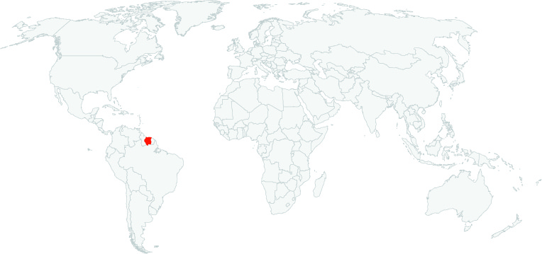
One of Suriname’s most prolific wildlife-trafficking groups is a network of currency traders that has branched out into smuggling migrants from southern China into the United States. They charge roughly $55,000 per person, according to ELI reports provided to the U.S. government. Once the migrants reach Suriname, the smugglers give them false passports that they use to reach Mexico. From there, they head into California.
“The problem is U.S. law enforcement agencies and governments in Latin America lack the resources, language skills and cultural knowledge to dismantle these networks or even figure out the magnitude of their reach,” said Leland Lazarus, an expert on China-Latin America relations at Florida International University.
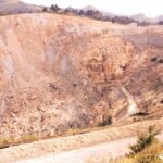
Mining is one of the fastest growing causes of deforestation, with a new report published by the World Resources Institue (WRI) revealing that 1.4 million hectares of forests, an area the size of Montenegro, was lost to the extraction of coal, iron and industrial minerals for the 20 years to 2020.Since the turn of the century, mining has increased by 52%. This includes tropical primary rainforests, some of the world’s most important ecosystems where mining is a growing loss driver, and Indigenous and local community territories, where people depend on forests for their livelihoods.
More than 89% of the loss is concentrated in just 11 countries, including Indonesia, Brazil, Russia, the United States, Canada, Peru, Ghana, Suriname, Myanmar, Australia and Guyana.
A series of recently published data is shining a new light on patterns of deforestation in the Amazon, revealing where crops, cattle ranching and mining are encroaching on the rainforest.
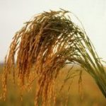
Some of the crops are well-known drivers of deforestation, such as soy, but lesser-discussed crops are also present in the region, such as rice and sorghum.
Despite its environmental track record, Suriname is still the only country in South America that hasn’t formally recognized the territorial rights of Indigenous and Maroon peoples.
The Saamaka claim that a 2007 ruling by the Inter-American Court of Human Rights should give them collective land rights, yet the government continues to grant forestry and mining concessions on their land. The Surinamese government has granted 447,000 hectares (1.1 million acres) of concessions on Saamaka land, or 32% of the territory, according to the International Land Coalition.
In a letter to the president this month, Saamaka communities asked the government to stop granting land concessions and to officially demarcate their territory.
Since 2007, the Inter-American Commission on Human Rights (IACHR) has ruled on several occasions that Suriname should suspend harmful economic activities and recognise and respect the territorial boundaries of about 30,000 Saamaka people. However, since the initial IACHR judgment, deforestation in Saamaka lands has increased fourfold. Concessions have also been granted to multinational mining companies and the timber industry, upsetting and dividing Indigenous and tribal communities with historical claims to collective lands.
Amazon nations have attacked in a joint declaration the “proliferation” of environmental rules in trade, echoing a growing backlash against new EU deforestation requirements.
The final document does not single out the European law specifically, but it condemns “the proliferation of unilateral trade measures based on environmental requirements and norms which constitute trade barriers”.
Mongabay has begun publishing a new edition of the book, “A Perfect Storm in the Amazon,” in short installments and in three languages: Spanish, English and Portuguese.
Chronicling the efforts of nine Amazonian countries to curb deforestation, this edition provides an overview of the topics most relevant to the conservation of the region’s biodiversity, ecosystem services and Indigenous cultures, as well as a description of the conventional and sustainable development models that are vying for space within the regional economy.
Click here to access the Global Illegal Logging and Associated Trade (ILAT) Risk assessment tool and to download the Forest Trends User Guide describing the functionality of the ILAT Risk Data Tool.
Click here to access the Cattle Data Tool.


